|
home | photosimulation & design viz | viaduct structures | east corridor over airport boulevard |
|
East Corridor over Airport Boulevard
Photosimulations
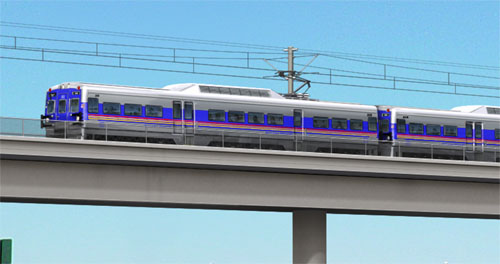
RTD FasTracks, Denver, Colorado The East Corridor is one of several proposed transit corridors in the Denver Regional Transportation District's (RTD) FasTracks program that have been evaluated throughout the Metro area as Environmental Impact Statements (EIS). Most of the corridors originate in downtown Denver's Union Terminal (DUT) and radiate out to the suburbs. POITRA Visual has provided several types of services on nearly all of these corridors at some point in their long histories. POITRA created and managed the East Corridor EIS public website. * The East Corridor takes advantage of abandoned or little used freight rail corridors that served Denver's northern suburbs and then turns east to the Denver International Airport (DIA). Because of the length of the line and possible interaction with commercial freight rail, a heavy commuter rail concept was proposed. Electric Multiple Units (EMU) were chosen as the most appropriate vehicle. |


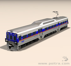

POITRA artists created custom 3D models of the EMU commuter vehicle with RTD marking combinations. |
| ||||||||||||||||||||||||||||
|
| |||||||||||||||||||||||||||


|
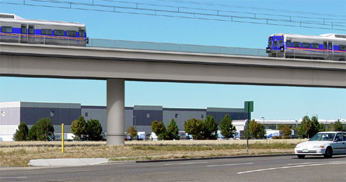
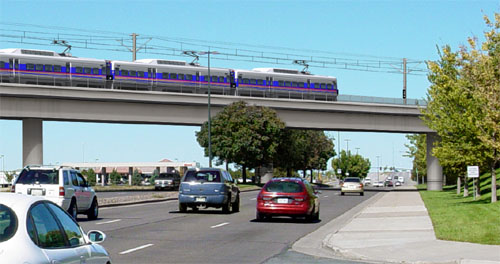
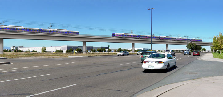
The East Corridor mainline turns north as it crosses Airport Boulevard as it heads east towards DIA. This simulation pictures the line looking north on Airport Boulevard at what is termed the City of Aurora Gateway.
The line is carried on pre-cast concrete viaduct up from Smith Road crossing Airport and curving north to cross I-70, then down to grade parallel to Ariport Boulevard to the north. Little preparation of the original photograph was required. POITRA constructed an accurate detailed 3D computer model of the proposed viaduct structure and the surrounding landmarks such as the existing curbs and medians. The viaduct model included the safety fencing, signage, overhead catenary systems and the POITRA model EMU vehicles. The models were then camera matched, lighted, rendered and composited with the photograph to create a photo-realistic simulation. The simulations were finished using traditional image editing methods. POITRA relied upon its principal's previous career experience in bridge design to complete the viaduct efficiently from very conceptual plans.
The finished simulations were used in meetings with the City and County of Denver, Fastracks public stakeholders and also in the EIS document. |
Take a closer look! The highly developed skills of the Artists at POITRA Visual make your concept a reality. (click to magnify)
| |||||||||||||||||||||